OpenHUR (Hydrologic Unit Reference)
OpenHUR (Hydrologic Unit Reference) is a watershed infrastructure research initiative conceived and stewarded by GeoComms GIS Solutions, Inc.
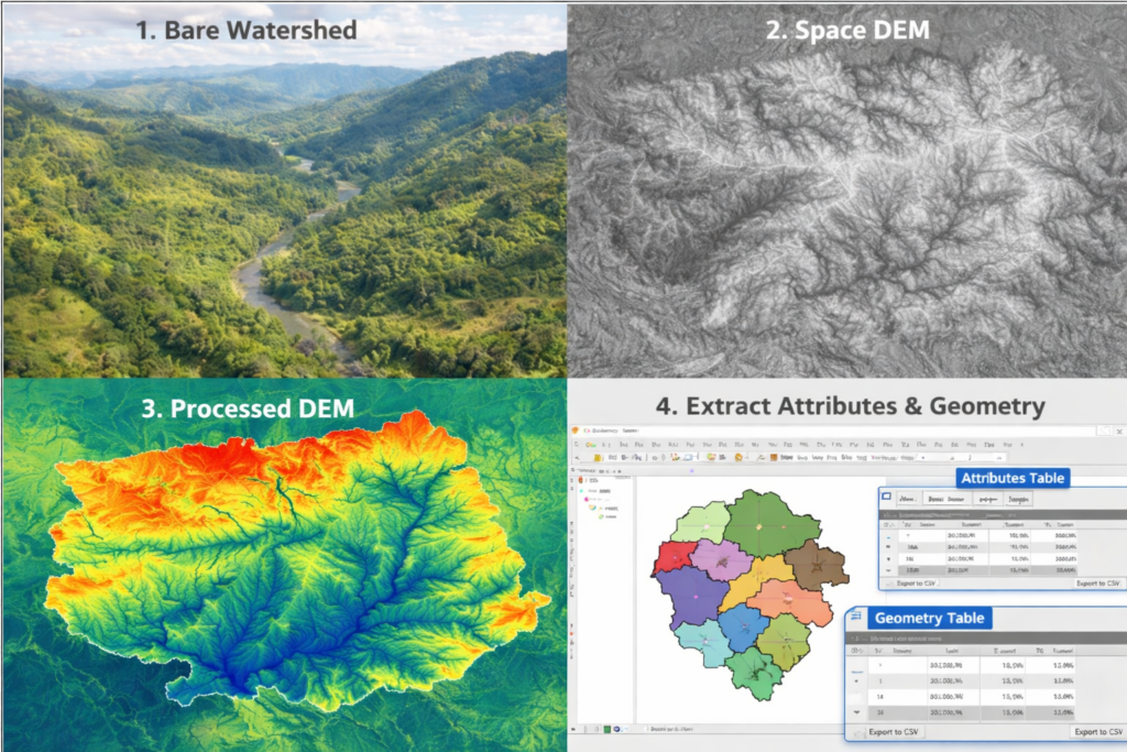
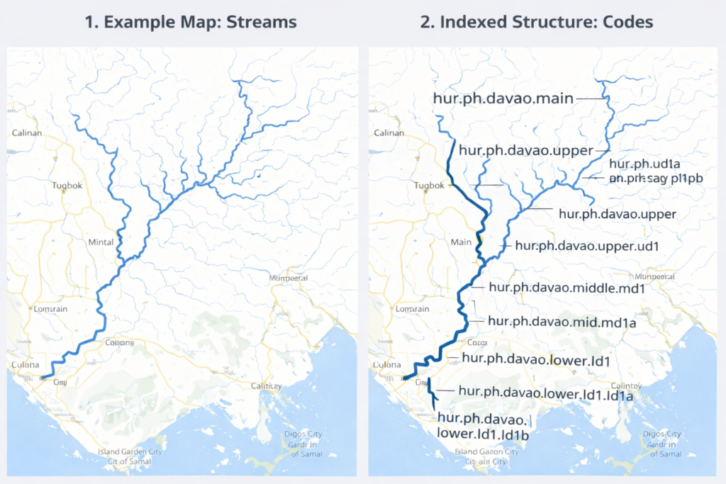
OpenHUR is a digital watershed infrastructure framework that organizes river basins into structured hydrologic networks, enabling monitoring, analysis, and decision support through a geospatial SaaS platform.
Who This Is For
OpenHUR is designed for institutions and professionals responsible for understanding, monitoring, and managing river basins and watershed systems.
Watershed and River Basin Managers
Professionals responsible for managing watershed resources, protecting river systems, and coordinating basin-level environmental programs. OpenHUR provides structured hydrologic networks and monitoring tools to help managers trace upstream influences, prioritize sub-catchments, and guide watershed interventions.
Disaster Risk Reduction (DRR) and Flood & Landslide Risk Offices
Government agencies tasked with disaster preparedness and response. OpenHUR supports early warning and situational awareness by linking upstream rainfall, terrain response, and river conditions to downstream flood or landslide risks, helping decision-makers act before impacts escalate.
Environmental Regulators
Authorities responsible for enforcing environmental regulations and protecting water quality. OpenHUR enables regulators to trace potential upstream sources of pollution, monitor watershed conditions, and identify priority areas for inspection, enforcement, and environmental protection.
Water Utilities and Infrastructure Planners
Organizations managing water supply systems, reservoirs, and watershed infrastructure. OpenHUR helps utilities understand upstream watershed conditions, anticipate sediment or contamination risks, and plan long-term water resource protection strategies.
Researchers and Watershed Monitoring Specialists
Scientists, analysts, and research institutions studying hydrology, watershed dynamics, and environmental monitoring. OpenHUR provides a structured hydrologic framework that supports data integration, basin analysis, and the development of decision-support tools.